
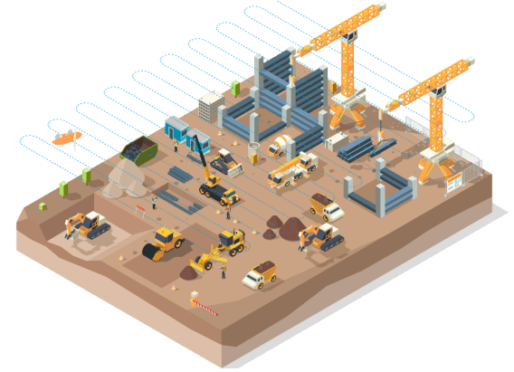
Reliable mapping for construction and infrastructure


Deliver fast and reliable data, without reflight headaches
Get survey data in time for key earthworks decisions
Wingtra helps teams survey earthworks sites in way less field time than ground-based methods or other drones.
- Get frequent survey data to support every bid, progress check and payment review
- Validate earthworks survey data to 3 cm (0.1 ft) accuracy
- A guided workflow that helps teams repeat surveys across sites and crews
Airport runway inspection with drone imagery and AI crack classification
Wingtra and gNext deliver end-to-end crack detection and classification that’s fast, scalable, and accurate. Reduce closures, cut manual crack classification, and comply with FAA standards faster.
- Minimize costly airport closures by mapping full runways in a single flight
- Capture high-res imagery for AI crack classification
- Cut labor time and reduce human error
Monitor your rail infrastructure better while boosting revenue
Map three miles of tracks in just 20 minutes, saving your team from grueling terrain treks.
Get accurate data for hydrology forecasts and gauge deviations quickly. Slash costs by mapping without big crews working long hours or halting railway traffic.

Digital modeling

Create high-accuracy maps in any coordinate system
Pay contractors based on accurate cut and fill calculations
Optimize your site measurements. Easily map your entire site in a single flight without stopping machinery or going into risky spots.
With just a few clicks, overlay maps and precisely analyze volume differences to generate cut and fill reports on the same day. The quick turnaround and high accuracy make dealing with contractor billing a breeze.

Digital modeling
Export accurate volume reports
Accurate maps for precise solar panel installation
Keep up with the daily need for accurate maps in your expanding solar fields.
Launch from a safe spot, cover the entire active site in just hours, and get survey-grade maps with minimal checkpoints for verified accuracy. This efficient approach keeps you ahead in all your mapping tasks.
Digital modeling
Export accurate topographic maps
Same-day, data-driven decisions based on precise maps
Survey your whole construction site in one morning and get accurate info just hours later.
Use the extra time for in-depth inspection of a lifelike, detailed map that drives smarter decisions. The vivid colors and sharp contrasts allow for quick detection of changes and materials at a glance.
Digital modeling
Create high-accuracy maps in any coordinate system
Survey roads for maintenance without stopping traffic
Keep traffic moving and save thousands on road surveys. Map in a day, and get orthomosaics and comparison reports quickly.
Our mapping platform captures detailed data on extensive road stretches, even in traffic, so you can spot issues and plan your work accurately.
Digital modeling
OUTPUT
Create high-accuracy maps in any coordinate system
Efficient topographical surveys in levee construction
Map your site and provide teams with highly-accurate maps in just hours.
Gather survey-grade data for hydrology, slope management, and road design with centimeter-level horizontal and vertical accuracy. Everyone from design to operation teams can access the data and make informed decisions.
Digital modeling
Create high accuracy maps
Win more bids, hit every deadline, and keep budgets tight
Monitor your rail infrastructure effectively for a much better price
Effortlessly monitor rail line defects without the need for on-site crews or shutting down the line.
Save days of fieldwork by efficiently flying long corridors. Generate accurate maps to precisely measure and identify necessary work with safety reports produced automatically.
")
Pay contractors based on accurate cut and fill calculations
Make earthwork billing transparent and easy. Cover your site in a single flight without interrupting machinery.
Get exact volume measurements for any site size, on-demand, and avoid unnecessary discussions with contractors.

Add thousands of dollars to your quarterly margins with precise reporting
Map your entire site quickly and process data the same day to keep a sharp eye on progress.
Spot and fix production issues fast with accurate, detailed maps. These up-to-the-minute insights help you plan smarter and improve your bottom line.
of daily mapping

Accurate maps for precise solar panel installation
Stay on top of your solar farm projects with daily mapping. Gather precision data on your entire site quickly, and get same-day insights.
Analyze topography and see every solar panel’s position, angle, and height at a glance, speeding up your planning and progress reports. This new level of efficiency can translate into millions saved.
Data-driven decisions made from same-day maps
Get the accuracy you need, from centimeter-level survey data to straightforward progress reports.
Capture and process everything the same day—say goodbye to outdated information and errors. Streamline your planning to optimize time and effort.

Survey roads for maintenance without stopping traffic
Keep traffic moving, and save big on road surveys. Effortlessly check for asphalt damage while traffic flows.
Cover vast corridors and drill down to even the smallest cracks. Spot issues and plan precise patchwork from your desk with high-resolution Wingtra data.

Reduce air strip shutdown by detecting cracks more efficiently
Map the entire airport in just a day with minimal shutdown, slashing time and costs.
Collect accurate data for crack detection, maintenance, and aviation authority reports in only a few flights. Take off and land from safe zones, protecting your crew from airplane hazards, turbulence, and noise.
to make better decisions

Efficient topographical surveys in levee constructions
Capture and map your levee site down to 3 cm vertical accuracy on the same day.
Share your findings instantly to enhance grading, design, and planning. Collaborate more effectively and make smarter decisions with these regular mapping updates. Watch costs drop and margins rise.

Compatible with


A single mapping solution for all your jobs
Efficient mapping

Better insights

Peace of mind
Easy integration
Recommended solution

Efficiently and reliably collect accurate survey data with the user-friendly WingtraOne drone.

