
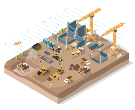
Six ways drones in construction add value
The use of drones in construction is now common place. In fact, the impact is now so large that companies will fall behind industry standards without them. So it literally pays to know about how construction drones impact workflows at all stages of a building cycle.
This—along with an understanding of how different construction drones work for different applications—will help you decide what the best drones for your construction projects are. First, let’s look at the six ways they will help you run your construction site:

1. Significantly safer sites

Did you know that between six and nine percent of construction project costs are injury related? This leads to increased insurance prices and reduced profit margins. A deadly accident can end a construction company all together.
The true cost of construction incidents

2. Massive savings on survey-grade site surveys
Before construction drones, topographical, planning, and inspection insights were often based on disjointed information that took days to gather, analyze and share. Since sites progress fast, this information was always slightly outdated.
It’s now possible to gather precise, photorealistic details across an entire active site area in a matter of hours, with just one or two drone pilots leading the collection.
This means that at every stage of your project, fast, comprehensive and accurate views and analytics are available, on demand, to all site managers, contractors and stakeholders, within hours not days.
Plus, if you are conducting frequent drone construction surveys, their outputs are on record to answer questions or assess details with a click of a mouse rather than the time of a worker to drive out and check.
If a construction company is still using traditional survey crew, they’ll spend about $150 an hour for several days. That's a lot of money. Or they can go out and buy this drone, and it’s going to pay for itself very quickly. As busy as we are, I think the drone probably paid for itself within the first month of us buying it. It was just worth it to buy.
Alex Lowry
Certified Drone Operator, Brent Scarbrough and Co.
Traditional survey

WingtraOne
3. Real-time tracking (via updated, accurate construction drone data)
Miscalculations are only natural when hundreds of decisions are made on a construction site every day. Drone data gathered at regular intervals allows project managers to check all areas of a site not only for progress, but also for the exact alignment of as-planned to as-built.
Many times, the earlier any error is caught in the process, the less costly it is to rectify, and the less delay it costs the entire project. Regularly updated views of activity across a site allows tracking and saves countless hours and expensive delays.
Missing and stolen equipment is also a reality on busy construction sites. In fact, in the most recent annual equipment theft report by Verisk, stolen equipment costs the construction industry USD 1 billion per year. Up-to-date site views with centimeter-level resolution also help monitor security fences and the location of equipment on a regular basis.
What kinds of drones are used in construction?

4. Faster decisions and overall project times
Key stakeholders are often not situated onsight, and in some cases they’re not even in the same town. Up-to-date drone construction site data is available on the cloud and instantly to whoever has permission to view and manage it. This saves time and traveling costs when contractors, managers and owners need information.
Instant and updated site views enable checks and validation so that stakeholders get a precise view of as-built and as-planned, make decisions and approve next steps. When they can do this from anywhere, at any time, it speeds up overall project times.
ROI insight: Imagine saving days and the cost of airline tickets to fly stakeholders to a project site, when the site could be viewed on a tablet or screen. That’s just one of the ways construction drones pay for themselves.
5. Expedited contract reconciliation
When it comes to agreeing on sizes of stockpiles and amounts of earth moved in a certain period, it’s much easier to do with more exact measurements. This is what drones offer. Thanks to high-resolution payloads and photogrammetry software, millions of data points cover each stockpile and surface, offering much more precise volume and progress analytics.
Imagine daily views, and you start to get an idea of how this prevents long discussions at the reconciliation phase. Owners, contractors and subcontractors are all starting to rely on drone data to compare site activities. Those who don’t, have less to bring to the table. Those who do, simply pull up the files, flip through the days, display measurements and prove or disprove the claims.
ROI insight: On busy construction sites with tight deadlines, the last thing you want to spend time on is on disputed claims of work done and earth moved. With regular frequent drone data snapshots of the worksite, everything is on record, accurate and available at the click of a point on the screen.
This successive display of drone flights gives insight into how powerful daily records of topographical surveys are in terms of recording progress, offering accurate analytics and reconciling any discussions about what and how much was moved, when.
6. Lower overhead maintenance
ROI insight: Maintenance checks and work can be so expensive that site owners try to avoid them. But in the long run, it’s impossible to estimate the destructive cost of incidents and the loss of life due to failed or outdated infrastructure. Powerful drone platforms lower the investment required to perform more effective maintenance.
Why ease-of-use matters in a construction drone
Construction sites don’t exist in vacuums—they operate on deadlines, are subject to weather and are themselves rugged environments. It’s important that the drone solution you choose is not only rugged enough to handle such environments, but also easy enough to operate so that you can reap the benefits of on-demand data.
For example, if you have a belly-landing drone, the setup will be difficult since you need large, soft areas for it to land. So vertical take-off and landing (VTOL) is the best option for construction drones. Beyond this, you need to know you can conduct a quick survey of a large area in a tight weather or time window to get the latest look at operations.

Use of drones in construction—in detail
1. Bidding and pre-planning

Before the survey began, BFW’s client already had ideas about where all of their panels and equipment would be placed during and after construction of the solar project. But from the digital terrain models based on the WingtraOne survey data, Cash was able to offer them more insight than they expected. This likely cut countless costs in time and money.
The client saw from the elevation maps where the solar farm would most definitely flood, so they rearranged their construction plans around the areas that would stay dry all year round.
They saw the visual representation and realized ‘that’s where the elevation drops off, and we’re not going to be able to put anything down in there.’ So we really gave them a good glimpse of the why and why not.
Jacob Cash
BFW Mobile Mapping and LiDAR Department Manager


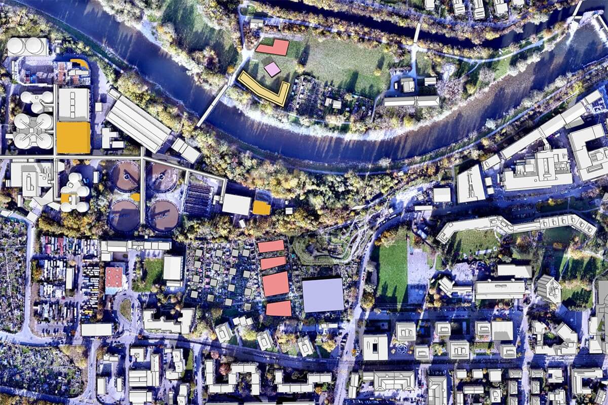
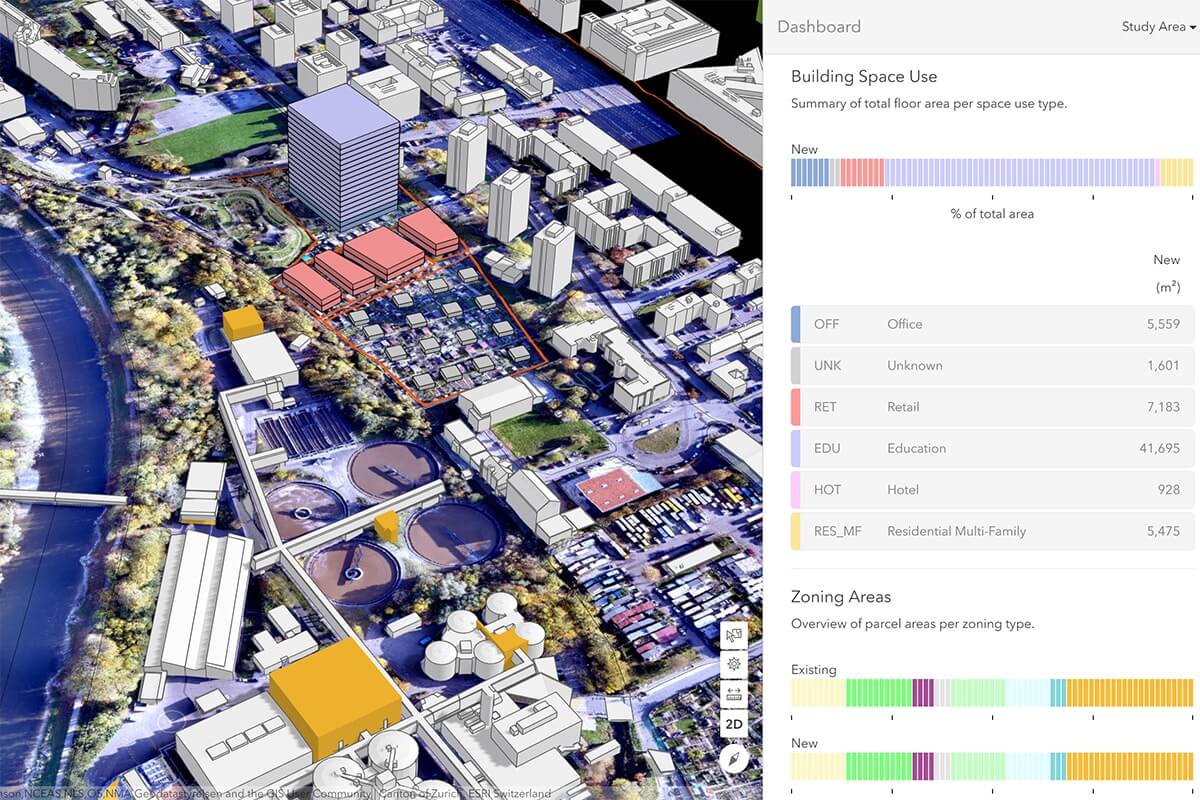
2. Planning and design

For example, you can overlay 3D models and buildings onto drone orthophotos of current infrastructure to get a clear sense of how a new building might look next to an existing one. Then you can explore particular details, like where shadows are casted and what kinds of outlooks/views will be available or obstructed.
In short, construction drone data enables you to see how new projects will impact the area from both a practical and an aesthetic viewpoint. You can also extract precise data such as curbs or manhole measurements and import them into your CAD or GIS software to enrich existing data.

I'm flying two or three times a day or every other day. I'll compare what I shoot in the field to the drone point cloud from WingtraOne GEN II [VTOL drone]. There are plenty of times I see shots that are 4/1000 [0.01 cm] of a difference or less. This is incredible accuracy.
Alex Lowry
Certified Drone Operator, Brent Scarbrough and Co.

3. Execution
Earthworks, volumes and contract reconciliation
From drone images, you can generate a point cloud consisting of thousands of points, each containing geospatial (X, Y, Z) and color information. Then, with photogrammetry software, you can get precise volume measurements and run a cut/fill analysis.

This daily cut-fill view based on WingtraOne drone-captured data saves money and time in several ways, including basic procurement of the output and minimizing discrepancy between measured and real-life earthworks.
For example, the Norwegian Road Administration hires contractors to build roads, and their chief engineer Gry C.S. Kjellsmoen said: “The drones help us to follow up with the contractors who build the road. We can agree on estimates, how the work will be carried out and the amount to be paid. We have everything they have done in detail, including the amount of debris that has been moved.”
More frequent controlling of as-built vs. as-design
Monitor site progress down to the fine details
During the construction phase, site managers have to control and validate completed work in order to permit continued work. The faster you are able to check and validate a task, the faster you can move on to the next task, saving time along the overall construction process.
Given the relatively low cost of using a drone to collect visual data on a construction site, it’s possible to carry out surveys on a regular basis and build up a record of progress.
This timeline of information can be used to control and validate tasks more quickly, saving time and ensuring that deadlines are met.

Faster communications, decisions and hazard identification
On construction projects, there are often several stakeholders in several locations who are all eager to know how things are progressing.
For this to be possible, stakeholders should visit the site, or hire a prohibitively expensive helicopter to collect aerial photos. And even if they did this, the pictures collected could be out of date by the next business day.
The visual data from regular drone surveys assists in on-demand (could be daily, weekly) operational planning. It furthermore helps in explaining how immediate work should be performed and helps identify safe or hazardous areas.
Visual reports can also be sent to customers, helping them to stay informed about how things are progressing in terms of time and budget.
Minimize rework and claims via tight documentation
When your project is moving forward, and it reaches a milestone, you want to be sure that everything has been achieved to the highest quality standard. Further construction is based on these milestones.
So if something has been done wrong, you’ll eventually get stuck, and you may have to tear down what has been done previously. Having up-to-date visual data can help you catch a mistake before it takes shape and avoids demolition and the waste of time and materials related to it.
And when mistakes are built over, you have regular documentation of the process, and you can check back to see where the mistake occurred more precisely and settle disputes without lengthy discussion, or even court cases.
Provide a comprehensive handover to the site owner
Detailed documentation presents advantages to both the contractors and the site owner, who will take over responsibility of the project once complete.
Specifically, the owner can look carefully through the documentation before agreeing to the handover, and contractors can prove that the work has been conducted as per requirements, including details on who did what.
4. Maintenance and asset inspection
Maintenance is usually deprioritized because it costs time and money and doesn’t bring much instant value to operations … at least not when they are running as usual. But as soon as you are faced with a serious problem due to lack of it, you can be held responsible and lose a lot of money.
That said, ensuring quality maintenance of assets is not always easy to do at a reasonable cost. By sending drones in the air, companies can visually inspect large assets or those located in hard-to-reach areas more quickly and cost-effectively.

The Alabama Department of Transportation spends most of its time on maintenance of roadways. They are using an oblique camera configuration to survey large stretches of road, fast, without flying over traffic. This 3D construction drone survey data helps them uate the condition of the roadways as well as erosion prevention infrastructure.


Drone imagery outputs
1. Orthophotos and orthomosaics

2. Point clouds

3. Digital surface models (DSMs) and digital terrain model (DTMs)

4. 3D models
5. Raw images
Why is WingtraOne a great fit for construction and infrastructure projects?

It covers large areas, fast
Many construction sites tend to use multicopters, because the initial investment is low. Also their ability to fly around a building or around infrastructure, such as a bridge, makes them excellent tools for small-scale inspection.
While multirotors are cost effective and great to have on hand for small areas and vertical assets, their low coverage makes them too expensive—in terms of time and money— for topographical surveying and larger project sites.
Just think about a highway, a railway track, a water retention basin or drone mapping large infrastructure like solar farms or an airport. It will take multiple flights and multiple days to survey the whole area with a multirotor. And it will take even longer to get higher accuracy since the cameras in multirotors are lower resolution so they need to be flown lower.
This stretch of road (7 km, 4.3 miles) was captured in a single flight with the WingtraOne drone using its corridor mapping feature.
Maximum coverage with one flight
at 1.9 cm/px (0.75 in/px) GSD
RGB61
310 ha (766 ac)

170 ha (420 ac)

drones
29 ha (71 ac)


With the quadcopter, we started to get overwhelmed with how much we were going to have to fly … it would be nonstop. WingtraOne turned that planning around, and Sean could strategically see what areas he was going to fly on which days and in what order. It was no longer feeling like we were never going to finish.
Alex Ramirez
Senior Manager, Business Technology at PCL
It features vertical take-off and landing (VTOL)
Another advantage of WingtraOne for large areas is the vertical take-off and landing. “We looked at fixed-wing drones, but they need a passage to land, and we often have small places for landing. We can take off and land everywhere with WingtraOne. It’s really good,” explained Kjellsmoen, from the Norwegian Roads Administration.
WingtraOne offers fully-automated flight, it takes off from and lands in a predictable and tight space without requiring the operator to risk entering the construction site itself.
In this video we see the WingtraOne VTOL drone taking off and landing vertically like a helicopter and tilting to forward flight mode to fly like a fixed-wing aircraft.
WingtraOne’s vertical take-off and landing enables it to carry heavier payloads packing twice the resolution of hand-launched classical fixed-wings. Also, unlike drones that land on their belly, WingtraOne’s cameras never come into contact with the ground. This protects the high-quality sensors from abrasion, dust and dirt common to rough terrain found on construction sites.
It captures high accuracy and resolution data

WingtraOne can map a 130 ha (320 ac) quarry in an hour’s flight. The resolution of the final map allows you to zoom in and see a coin lying on the ground. And what is best is that it’s possible to know the exact coordinates of the coin down to an absolute accuracy of 1 cm (0.4 in).
It’s super easy to use
We're going to the site knowing we will get the job done and done right. That's a big advantage, just the ease of use. If somebody with no experience can go out and get started and trained on the WingtraOne GEN II, I think they would really see the advantage it brings to their program.
J.D. D’Arville
UAS Program Administrator at ALDOT
PS: It’s even easy to use in cases of strict regulations
Did you know?
WingtraOne GEN II is on the Blue UAS Cleared List due to its points of production, parts sourcing, reliability, high performance and security features.
With this clearance, government agencies in the US enjoy Department of Defense pre-approval to gather data over areas that otherwise require applications for exception to policy.
It has a smooth corridor-mapping feature
Fly through a road of 22 km (13.7 mile) road by Hades Geodeesia. The generated point cloud contains 1.2 billion points, with a GSD of 1.2 cm/px (0.4 in/px) allowing for precise measurements. It took nine hours with a WingtraOne drone to collect the data in the field.
Mapping the same road two years ago, we used another drone, covering 3 km (1.8 mi) of road per day. Right now, in that same time, we cover the whole road, 22 km (14 mil), with WingtraOne.
Vaiko Veeleid
CEO of Hades Geodeesia
Wingtra data works with all post-processing software
WingtraOne’s images are standard and software-agnostic. This means you can process them with all major photogrammetry software out there. Further integrations, such as the one with Trimble Business Center, makes getting highly-accurate geospatial data to CAD or GIS software more seamless.
What is the best construction drone?
- Accurate data
- Reliable capture in rugged conditions
- Efficient data capture for daily or weekly views
- Ease of use in the field
- Smooth workflow from capture to outputs
- Easy access to results from all stakeholders
- Operation without interruptions for repair/replacement
- Clear return on investment
- Regulations clearance
Back in the day, we would go fly a large area with a Phantom 4 or a Mavic 2 Pro. It takes forever, with the quads. When we purchased the WingtraOne, it really opened us up to doing large projects. And we have done some very large ones for imagery and 3D reality meshes.
J.D. D’Arville
UAS Program Administrator at ALDOT
